![]()
What is Photogrammetry and How Does DJS Associates Utilize It to Aid in Documentation?
Jon W. Adams, Director of 3D Reality Capture
In simple terms, photogrammetry is a process by which measurements can be obtained from photographs. While this can be accomplished from a single image and reference measurement(s), the way in which we utilize photogrammetry to aid in documentation is a variant technique of photogrammetry known as “structure from motion”.
The idea in this technique is that by capturing images (photographs) from differing vantage points (motion, i.e., moving the camera to various positions around a subject), common features of the subject item/area will be captured across a range of images. These common features across image series can then be located in three-dimensional space via triangulation, providing a single point with a precise coordinate in space.
Repeated thousands, if not millions of times, this matching process can produce a “point cloud”, similar to the outputs generated from laser scanning. This point cloud can then be utilized as a representative scale-model of the item/area. With proper techniques, the accuracy of this scale model can rival that of laser scanning.
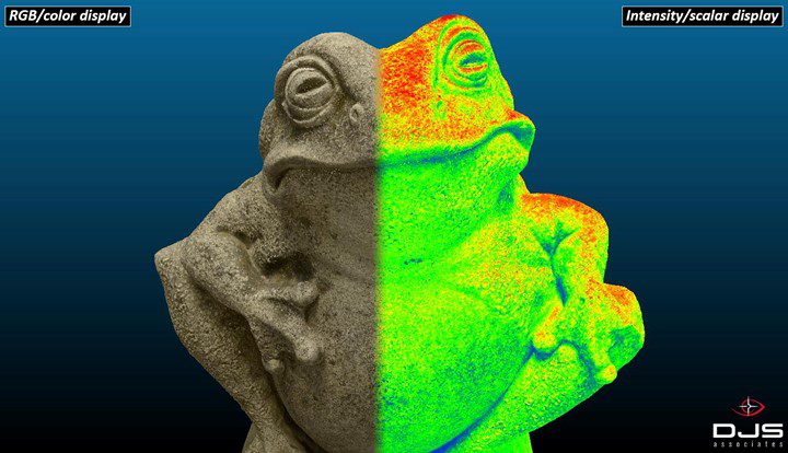
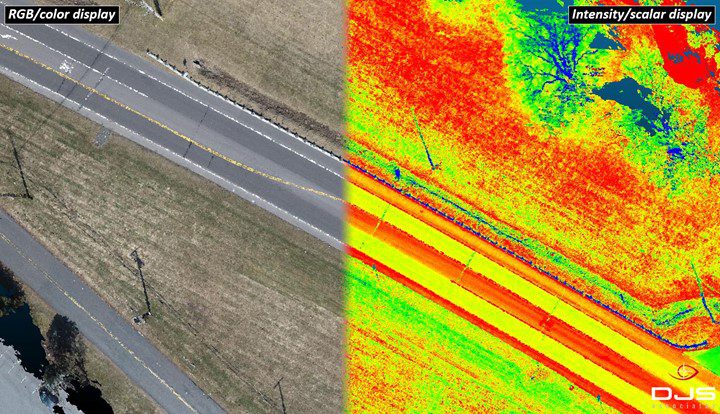
Since a photogrammetric reconstruction is based on the features of an image, the level of detail that can be achieved in the output point cloud is directly related to the number of pixels that are present in the images, of the item/area of interest. If the subject is a large area, and is being captured by drone, the amount of detail will be less than if the subject is a small object, captured by a camera that is feet/inches away.
Figures 1 & 2 below are examples of large-and small-scale photogrammetry.
Have A Question About This Article or Want to Contact the Expert?
Request An Expert
Fill out the form below so we may refer an expert
Areas of Expertise
Additional Areas of Expertise
From Our Blog
Who is DJS Associates?
